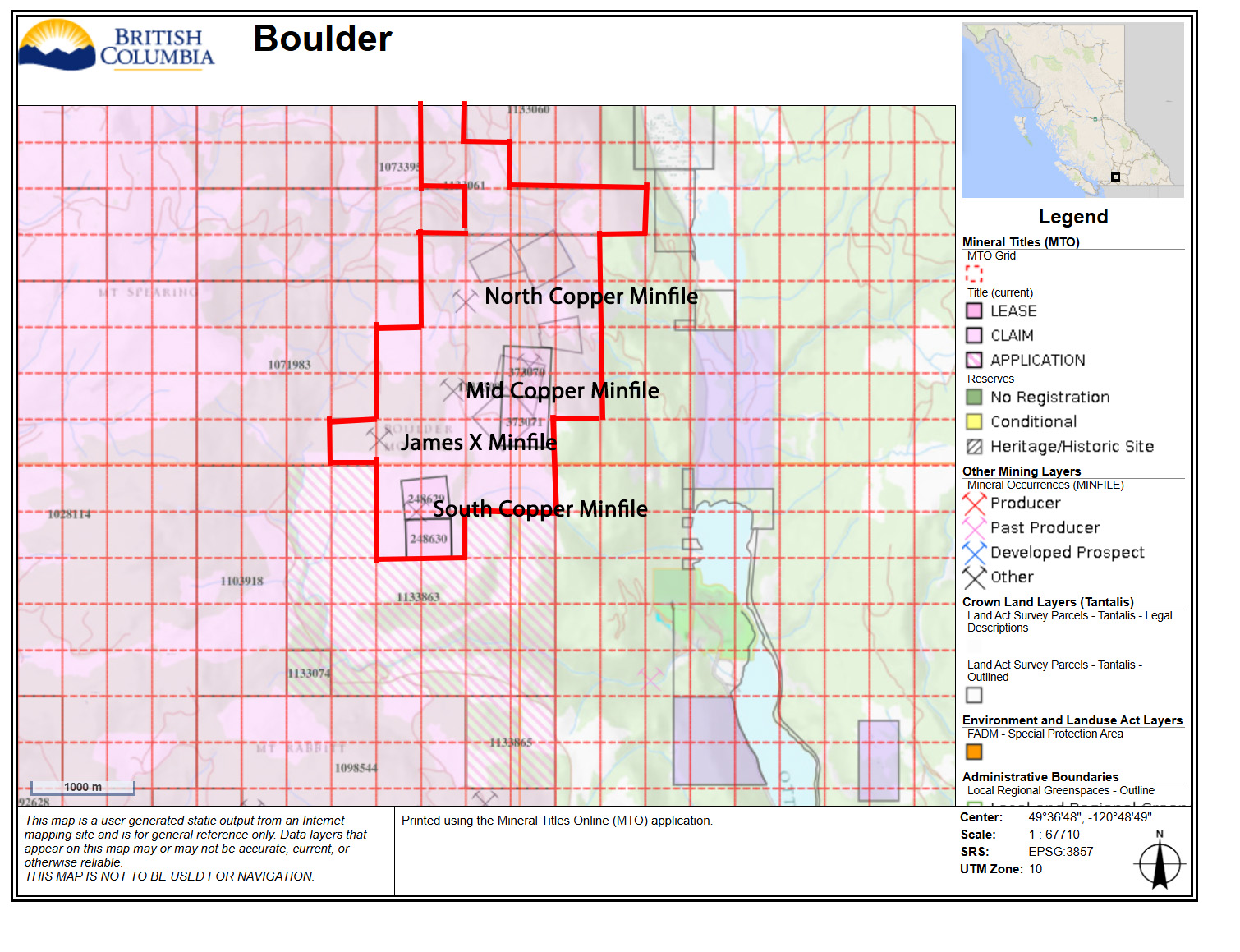
Porphyry, skarn and lode-gold target
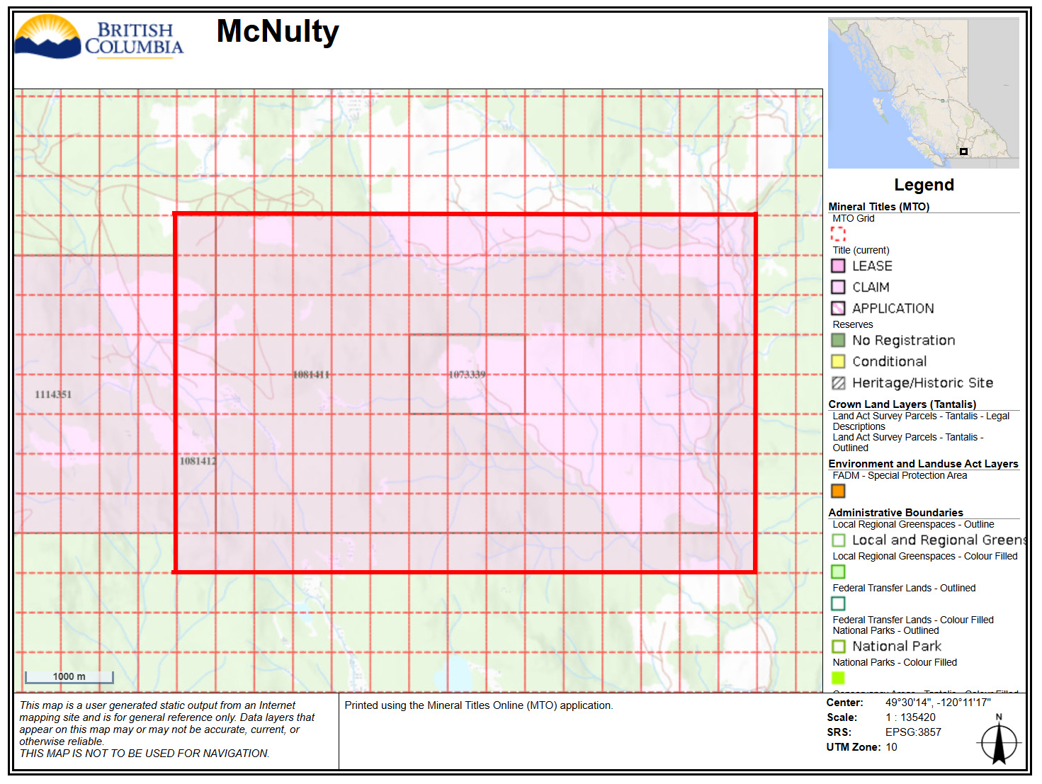
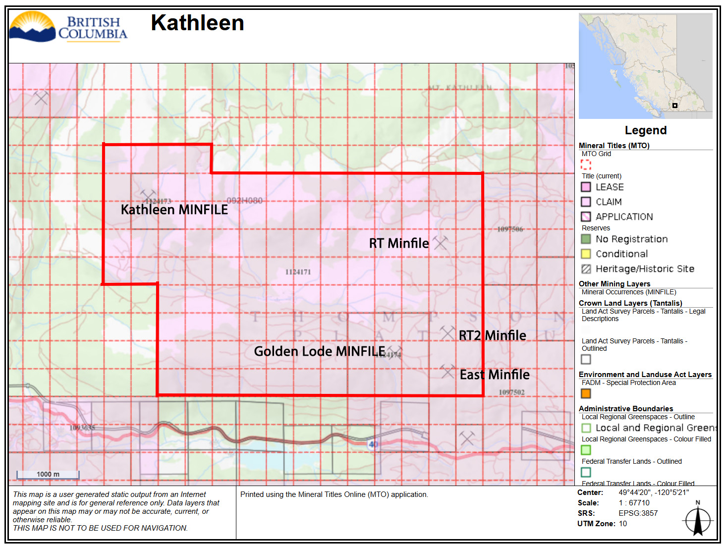
Kathleen Mountain Property
The Kathleen Mountain Property is located in the Interior Plateau area of south-central British Columbia, approximately 50 kilometres northeast of Princeton. The property covers 2,254.87 hectares in the Similkameen Mining Division.
Location and access
The property can be accessed from Princeton using regional road and forest service road networks that run near the property. Access into the property is provided by Glen Lake FSR and associated spur roads, with some areas requiring 4x4 vehicles.
Geological setting
The property lies within the Intermontane Belt of the Canadian Cordillera and is split north-south by the Pennask and Osprey Lake batholiths. The Kathleen Mountain showing is hosted in the Pennask batholith area, while the Golden Lode showing is situated within the Osprey Lake intrusive complex and associated with small porphyry dikes.
Mineralization highlights
- Golden Lode is one of the two key MINFILE showings identified on the Kathleen Mountain Property.
- The showing is situated within the Osprey Lake intrusive complex and associated with small porphyry dikes.
- Historical work included trenching, mapping, geochemistry and drilling focused around the Main Trench area.
- 1995–2000 drilling under the Main Trench returned anomalous to economic gold and copper values over short core lengths.
- Reported drill results include 2.07 g/t Au, 9.69 g/t Ag and 0.36% Cu over 3.1 m, and 6.1 g/t Au, 23.79 g/t Ag and 0.79% Cu over 1.38 m.
- The Kathleen Mountain showing is hosted in the Pennask batholith region in the northern part of the property.
- Early work included mapping, geochemistry and limited geophysics in the 1970s.
- Exel Explorations completed six diamond drill holes in 1974 and 1975 totaling 170 m.
- Inco and others completed reconnaissance mapping and prospecting in the 1980s.
- The area remains relevant to the broader porphyry copper-molybdenum and skarn exploration model.
2018 DCIP and Magnetics
- SJ Geophysics acquired 34 km of Volterra 3D induced polarization data and 34 km of ground magnetic data.
- The survey grid consisted of 17 north-south lines, each 2 km long and spaced 200 m apart.
- The resistivity model outlines a likely contact between the Pennask and Osprey Lake batholiths.
- A kilometre-wide north-south corridor of low to moderate resistivity features is interpreted as highly fractured.
- A strong low-resistivity feature less than 500 ohm-m is approximately 200 m wide and extends to depth.
Exploration Targets
- The 2018 model highlights two subtle chargeability features with associated resistivity and magnetic features.
- One target is associated with a low-resistivity fault, a magnetic high and subtle near-surface chargeability.
- A second circular chargeability pod is approximately 200 m in diameter and centered near 709800E / 5513900N.
- The kilometre-wide corridor warrants further investigation as a possible controlling structure for mineralization.
- The report recommends integrating geophysics with geology, soil geochemistry, airborne magnetics and radiometrics.
Exploration potential
Kathleen Mountain combines known MINFILE showings, historical trenching and drilling, porphyry-style intrusive geology, and 2018 DCIP and magnetic targets. The north-south resistivity corridor, subtle chargeability features, magnetic features and historic Golden Lode drill results provide a strong basis for further integrated interpretation and target refinement.